Low-level windshear
Here’s what to do when LLWS is encountered during critical phases of flight.
By Karsten Shein
Comm-Inst. Climate Scientist

Downburst windshear can cause aircraft to deviate from the approach path. If not recognized quickly, it can lead to incorrect pilot inputs and loss of control.
Approaching the threshold, the flying pilot was trying to keep the wings level in the gusty crosswind. Suddenly, the stall warning activated and the aircraft seemed to drop from the sky. Both pilots recognized instantly what was happening. They throttled up, but the rapid descent in the last 50 ft resulted in a hard landing that burst 2 of the mains and collapsed a strut. Although no one was injured, the aircraft was damaged substantially.
It’s likely that most pilots have experienced low-level windshear (LLWS), and all should be aware how dangerous it can be. Many will recall the crash of Delta Air Lines Flight 191 at DFW (Intl, Dallas-Fort Worth TX) in 1985 after the aircraft encountered a microburst that robbed it of lift at a critical moment. Although tragic, that accident led to improved pilot training and the establishment of LLWS reporting systems at many large airports worldwide.
Windshear occurs when air flowing in one direction at a certain speed is adjacent to or intersecting wind moving in a different direction and/or at a different speed. In many cases, the contact region will be one of turbulent vortices, or eddies – the strength of which are the product of the difference in the wind speeds and directions.
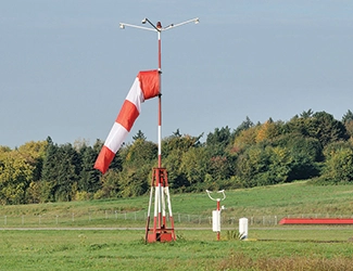
Windshear can occur along horizontal or vertical boundaries and at any altitude, and any shear can be strong enough to be a danger to aircraft. However, horizontal windshear in close proximity to the ground – that is LLWS – can be especially dangerous simply because aircraft tend to encounter it at a time in the flight when the aircraft is moving slowly and is least maneuverable or responsive.
The accepted definition of LLWS is a windshear of 10 kts or more per 100 ft in a layer more than 200 ft thick which occurs within 2000 ft of the surface. Simply put, this means that the shear speed, or change in air speed relative to the aircraft, is changing rapidly within a small altitude range.
The shear speed can be produced by winds from a single direction suddenly slowing or accelerating as the surface is approached – something that often occurs in gusty conditions – or from wind changing direction substantially over those same altitudes. Either cause can result in a gain or loss of airspeed for the aircraft. The effect of the shear also depends on the size and type of aircraft. Smaller aircraft often have approach speeds closer to their stall speed than do larger aircraft.
Sources of LLWS
There are several main sources of LLWS, including thunderstorms, fronts, terrain, and thermal inversions. Thunderstorms are the most recognized source of LLWS. Mature thunderstorms contain both updrafts and downdrafts. Downdrafts can produce vertical winds exceeding 100 kts. When those downdrafts exit the storm, they may hit the ground with great force as a downburst, spreading out in all directions.
This fast-moving air can extend several miles from the storm, although the most intense, called microbursts, have a radius of less than 1.2 miles (2 km). The leading edge of the downburst is known as a gust front, and is often visible as it kicks up dust in its path. It is at this edge that the downburst air often rises in a roll vortex that can be several hundred feet in diameter.
Pilots experiencing a downburst on approach may suddenly see their airspeed increase or start ballooning above the glidepath. The urge is to reduce power to regain the controlled approach, but that is a trap. Approaching the downdraft core, the descending air will produce turbulence and attempt to push the aircraft to a lower altitude. Here, too, it can be tempting to raise the nose to maintain glidepath.
Once past the downdraft core, that headwind will transform into a tailwind, driving down airspeed to near stall territory and increasing sink rate, all at a time when the aircraft is no longer capable of immediate recovery.
For the past several decades, pilot training has emphasized the dangers of downbursts and how to recover from a downburst encounter. Of course, the best option is to avoid any active storm cells by at least 2 miles (3.2 km) on approach, and absolutely never fly through or beneath any thunderstorm of any strength.
Often, thunderstorms are the product of an approaching cold front, but the front itself is normally a place where wind changes speed and direction very rapidly, particularly at the surface. Ahead of the front, winds may be light and flowing toward a distant surface low. Behind the front, however, a strong pressure gradient drives faster winds perpendicular to the front. Also, along the front, cold air is undercutting warmer air, setting up a shear boundary along the edge of the front.
Mountains are another frequent source of LLWS. Not only do mountains produce standing waves beneath which rotors and severe turbulence can reach the surface, but strong, gravity-fed downslope (katabatic) flow may increase winds suddenly at the surface by 20 kts or more.
In general, caution should be exercised whenever landing at an airport downwind of a large mountain range, particularly if there is a strong vertical temperature gradient over the mountains or winds across the range are particularly strong. Standing wave clouds also suggest the possibility of LLWS at downwind airports.
Like mountains, even smaller obstacles may produce LLWS when strong winds pass them before reaching the runway. While this setup normally produces some turbulence, a strong turbulent eddy over the runway can subject a landing aircraft to a sudden change in the wind just before touchdown.
Lastly, temperature inversions are frequently places of LLWS. While the inversion itself doesn’t necessarily create windshear, the top of the inversion may mark a boundary between the surface air and the free atmosphere above. Especially at night, when the surface is cooling, a surface inversion can separate the 2 bodies of air.
Usually, such nocturnal inversions indicate relatively calm air near the surface, while stronger winds may persist above the inversion boundary. These inversions normally cap out at a few thousand feet, giving approaching aircraft time to adjust from any airspeed changes.
Forecasting and reporting LLWS
Although some of the sources of LLWS can be reasonably well forecast, their production of LLWS is not so easy to predict. LLWS should be assumed any time thunderstorms are mentioned in a terminal area forecast (TAF). If there is a chance for non-convective LLWS, TAFs will include mention of it using the code “WS” followed by the expected altitude, direction, and speed above the indicated altitude.
At airports with an LLWS system, alerts will be issued by ATC whenever LLWS is identified by the system. However, the most common way pilots learn of LLWS is when pilots who made the approach before them report it to the controllers or over common traffic advisory frequency (CTAF) at uncontrolled airports. Most reports will indicate the type of aircraft, runway, altitude, and the amount of airspeed change. For example, a windshear pilot report may state that a Citation X experienced a minus-10-kt shear at 1500 ft on approach to Rwy 18L. This can be enough to alert other aircraft to the shear.
Any time LLWS is forecast or reported, it is a good idea to apply a gust factor to your approach speed to maintain a bit more maneuverability and avoid a stall should shear rob you of lift at a critical moment. Gust factors are normally applied to crosswind landings, and, indeed, LLWS may be directional and involve crosswinds.
But even without a crosswind, if there is enough runway, an additional 5–10 kts of airspeed on approach adds a margin of safety when it comes to LLWS. If you encounter LLWS in landing configuration, do not change your flap settings or retract gear until you are clear of the LLWS.
Even though windshear is ephemeral, pilots should assume the possibility of encountering the shear reported, or maybe even stronger shear, regardless of whether another pilot reported that they didn’t experience it. Naturally, if you experience LLWS, let controllers or your fellow pilots know about it.
 Karsten Shein is cofounder of 2DegreesC.org. He was director of the Midwestern Regional Climate Center at the University of Illinois, and a NOAA and NASA climatologist. Shein holds a comm-inst pilot license.